Tuesday, 27 May 2008

Water Vole Survey Training in Glen Lochay


We had a very interesting training day today looking for water voles in Glen Lochay. In 2007, we taught ourselves how to do this. This year, prior to work beginning next week, we decided we needed more formal training. Our tutor was Helen Gray, Water Vole Conservation Officer with the Cairngorms National Park Authority, seen here on the left showing our surveyors Nelly & Gordon what to look for. Helen gave us a number of useful insights in to how she does her own survey work and this will give us more confidence moving forward this year. Her survey protocol is very similiar to what we established for ourselves last year, so great minds obviously think alike!!
Our TWCP area is strategically very important, covering a significant proportion of the buffer zone between two National Parks, which will only be 40 miles apart when the Cairngorms Park is extended south to Blair Atholl. Our survey work will therefore establish data that will be useful to both the Cairngorms and the Loch Lomond & Trossachs Parks. The Dochart system is within the LLTNPA area, and our data will be of direct relevance to them. This part of our survey work is an excellent example of how biodiversity functions on a large scale, and how data collected in one area can be useful to a number of organizations, often seemingingly further afield.
For more information on our project, please link here: Tay Western Catchments Project.

Water Vole Burrow in Glen Lochay


This is a water vole burrow, complete with a slide down to the water. There were no droppings at this particular hole, hence we cannot say that it is occupied this year, merely that water voles have been here recently. In fact, just to confuse things, there were field vole droppings at the entrance to this burrow, but it was definitely created by a water vole, it being about the size of a tennis ball and it is possible to get your hand in to it. Further along, we found water vole droppings, confirming presence in 2008, see below.

Water Vole Latrine in Glen Lochay


These are fresh water vole droppings from this year, in a "latrine" at the side of the watercourse. Their prescence confirms that water voles are at this site in 2008, a site where we recorded them last year as well.
It is just a little bit early for seeing signs just now, so we were happy to find these today.
We anticipate finding a lot more colonies of water voles in Glenlyon and Glen Dochart this summer.

Mink raft demonstration in Glen Lochay


Helen showed us how a mink raft works as we are planning to set some of these this summer in monitoring mode to see what mink are present in our three TWCP rivers. They might give us some information that we cannot pick up by tracks on sandy banks etc. Mink rafts were devised by the Game & Wildlife Conservation Trust as a practical and efficient means of eradicating mink. They are set at strategic points along main rivers and watercourses in monitoring mode, when any animal getting on to the raft leaves their footprints in a pad of wet clay. This pad is for demonstration purposes, and has dried out, but shows what mink tracks look like. Apparently, the top one is off a female and the bottom one a male (so Helen says!!)
These pads allow monitoring of a number of species, including otters, water voles, stoats, even pine martens, all of which have been known to use the rafts on occasion and kindly leave their prints behind. If mink tracks are detected and these other species are not in evidence, a cage trap can be added to catch the mink, and if one is captured, it can then be humanely destroyed.
We will not have time for trapping this summer, but would like to encourage a strategic eradication scheme in subsequent years.

Friday, 16 May 2008

Alistair Makinson Prints


We are just about to launch this important initiative to help fund habitat conservation projects on the Tay. Well-known artist Alistair Makinson is donating £20 from every print of each of five Tay fishing beats sold in aid of our TWCP project. This particular picture is of Newtyle. Framed prints will be hanging in the fishing huts of each of the participating beats. Scottish Native Woods are administering payment, you can find details of Alistair Makinson prints under How You Can Help on our website, www.scottishnativewoods.org.uk . Links will also be available through the home page of each fishing beat on FishTay. The prints will be limited to 75 of each beat, with the originals also being available for £1750.
There follows a few pictures of Newtyle. Over the next few days, I will be putting up the prints and a few photos of each of the other four beats.
If this works well, it is our intention to take this up to a higher level next year, and use the proceeds to help projects on Tayside more widely, not just TWCP.

Newtyle Hut


Close up of the Newtyle fishing hut.

Newtyle 2


Opposite the hut, looking upstream.

Tuesday, 13 May 2008

400 MILES- POINT OF LYON


Today we hit the milestone of 400 miles, by a bit of good planning, at the Point of Lyon, where the Lyon (right) meets the Tay (left). Once again I was accompanied by Philippa Furniss, who made a couple of really good spots today. We surveyed from the top of Keltney Burn down here to the Tay.
There will be no more survey work now done for a couple of weeks, we are planning on re-starting with a full team in early June, starting on the Lyon, then a few little bits to finish on the Lochay, then on to the Dochart.
Lots of preparations to do between now and then. There are nearly 30 posts here today, extending on to a second page, so plenty of reading. There are 3 short videos as well.

Point of Lyon Video

This is a short video of where the Lyon joins the Tay, which then heads down to Aberfeldy. Our other two TWCP rivers, the Lochay and Dochart, enter at the western end of Loch Tay. The Lyon used to be (and should still be) the most significant spawning tributary river of the Tay.

Salmon Fishermen


There were two salmon fishermen today just below the Point of Lyon.

Kenmore- Aberfeldy path


There is now a path extending from Kenmore to Aberfeldy, via Comrie Bridge, which follows the Tay for much of the way. The footpath then goes on to Grandtully. Over the past year or so, a number of these gates have been put in, with associated fencing. It is a nice walk, and definitely recommended. It is 6 miles from Kenmore to Aberfeldy. This gate is down near the Point of Tay.

Beech Seedlings


Here is a little beech seedling hiding away on the river bank. The main non- native on the main river Lyon down here is sycamore, with beech not obviously apparent to any great extent. However, it looks like they may be getting a start here now as well. This is important because they can easily come to dominate and shade out the natural vegetation in the riparian zone, leading to loss of biodiversity and increasing the risk of erosion.

Algal Growth


This algal growth is very characteristic of the Lyon. No-one is quite sure why this is the case, or if it does any harm, but it can be seen for most of the length of the river.

Three Fishes


There is an excellent little smiddy & gallery at Keltneyburn village. I decided to buy this on the way by. It is called Three Fishes.

Himalayam Balsam


This was an excellent spot today. Sharp-eyed Philippa noticed this Himalayam Balsam on broken ground where the Keltney Burn meets the Lyon. Invasive species, especially HB, are extremely difficult to identify at this time of year, and I had been anticipating having to re-do this section with volunteers later in the season to see if anything was there. We now know that there is. This is important in two regards. HB is very rare in the Tay system west of Aberfeldy, although TDSB confirmed its prescence near the Point of Lyon in 2006. We found some on the Dochart last year, now this area. Secondly, many river systems in Scotland are spending many tens of thousands of £ trying to eradicate these species, often when it it already too late. Dealing with these small areas now before they become an issue is very important. As far as we know, this is the first record of invasive plant species in the Lyon catchment. We will be giving this extra priority now later in the year, probably re-doing the main river and bigger burns by canoe, or by trained volunteers.
Well spotted Philippa!!
We found signs of mink on the lower Lyon today as well, another invasive species that we would be better off without.

Himalayam Balsam 2


This is what balsam looks like in the summer months (especially August), when it is much easier to identify by the purple flower.

Garth Castle


This is an imposing building, looking spectacular as it flies the flag in this Highland Perthshire landscape. In the 14th century, Alexander Stewart, the Wolf of Badenoch, resided here. He had the unsociable habit of throwing his enemies in to the Keltney Burn from its battlements, over 100 ft below. Rumour has it that 3 wives had the same fate........
Not a nice man.

Keltney Burn Woodlands


The woodlands along Keltneyburn are classified as an SAC (Special Area of Conservation) for their rich mix of species, notably ash, hazel and oak, but also willow, birch, alder, Scots Pine, bird cherry, elm, hawthorn, blackthorn and aspen. Much of the woodland area is very steep and dangerous to walk through, but this area is more accessible and is just a short walk above the village.

Keltney Burn Waterfall


This photo is a still of the waterfall in the next video, below.

Keltney Burn Waterfall.

This little waterfall is about 600 metres above the village of Keltneyburn. It sounds much noisier on the video than it was in real life.

Birds Singing in Oak Woodland at Keltney Burn

This sort video gives you a feel of the peace and quiet in the woodland along Keltney Burn.

3 Trees


There are many ways to identify trees, often using a mixture of different aspects. Being able to identify trees quickly by their bark saves you the bother of looking up all the time, although it is sometimes not that straightforward.
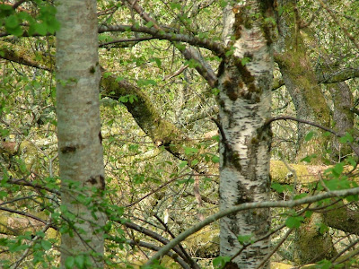
This photo illustrates the diversity of broadleaved tree species at Keltney Burn. From left, Aspen, Oak and Ash.
Who got all three right??

Ash & Birch


Ash left, Birch right.

Big Oaks


While there is very little evidence of fresh young oak trees here, oak is well represented inthe older age classes on both sides of the gorge.

Big Ash


There are a number of impressive ash trees along Keltneyburn, and hazel is very well represented.

Young Aspen


This is a young aspen, growing as part of a stand of about 40 trees.

Beech Trees in the SAC


The trees in the middle here are non-native beech, adding a bit of colour to this woodland, but not espescially desirable in a wood of this quality and national importance.

Dumb Dumpers


This is the first time we have recorded this particular issue so far. Going up the road from Keltneyburn, there are 12-14 different areas where people have been dumping off rubbish. The slope is close to 60% in places and most of this must surely end up in the watercourse. There was a mixture of domestic and commerical waste, including many part-filled drums. Goodness knows what is inside these, and what it might be doing to the river.

Glengoulandie Country Park


This is looking down on to Glengoulandie country park, on the way up the hill from Keltneyburn to Rannoch.

Soay Sheep at Glengoulandie


This little Soay lamb was out sunning itself today. Soay sheep come in different colours. This lamb is "light wild", the ram behind is "dark wild", both having a white belly. If they had the same colour all over they would be termed "light or dark self".
Soays are the most primitive breed of sheep in Britain.

Red Deer at Glengoulandie


These red deer are a popular attraction when travelling across to Rannoch. Two coaches stopped in the few minutes I was here today.

Fence Blockage


This side tributary is beyond where any migratory fish can get to, but it illustrates the kind of obstructions that can be created by unmaintained fences.

Dun Choillich


This is within the Highland Perthshire
Community Land Trust (HPCLT) area at Dun Choillich, where trust members are wanting to re-instate native woods and wildlife. You can see here the ground preparations that have been required to allow planting to take place.

Regenerating Birch Trees


This is a mixture of natural regeneration and planting along the watercourse, missing from many upland burns. This is within the Dun Choillich area.

Erosion


This photographs illustrates how much water must be carried in some of these watercourses. This is fairly close to the top of the catchment as well, and shows how dynamic many of these watercourses are.

Road to Scheihallion


This was our starting point today, right up at the top of the watershed on the road across to Rannoch. This is the most northerly point in our TWCP area.

Monday, 12 May 2008

The Cononish


There follows some random photos of the three rivers taken over the last 6 months or so.

This is the river Cononish, in the upper part of the Dochart catchment, the recognized headwaters of the Tay river system. Photograph courtesy of Tay Liason Committee.

Upper Lochay


This is on the upper Lochay, near Kenknock. Note the low water level, even in the winter months. The Lochay is heavily abstracted.

Benmore Burn


This is the Benmore Burn , one of the bigger tributaries on the Dochart system, and which is accessible and valuable to fish in its' lower reaches. It enters the top end of Loch Iubhair.

Allt Conait meets Lyon

This is where the Allt Conait meets the Lyon. This watercourse is fully abstracted, the water here coming from minor side-tributaries.

Good Riparian habitat on the Lochay


This is one of the lower minor tributaries on the Lochay illustrating good riparian habitat.

The Upper Lyon above Stronuich


This is the upper Lyon, above Stronuich dam. Photograph courtesy of TLC.

The Fillan Below Inverhaggernie Bridge


As described in title, back in February this year. Our two surveyors were setting off here by canoe.

The Fillan looking East


The same spot, looking east.

Friday, 9 May 2008

Loch an Daimh, Glen Lyon


This is the dam at Loch an Daimh, the secondary resevoir in Glen Lyon. I was out surveying today with Philippa Furniss who had expressed an interest in what we were doing. We walked from here down the Allt Conait, and then about three miles down the main stem of the Lyon to Bridge of Balgie. This watercourse is completely abstracted and is virtually dry. A series of steep waterfalls meant that only the last few hundred yards were accessible to fish anyway.
The main items of interest today related to woodlands. We found a number of impressive stands of aspen, and we located the furthest extent to which non-native beech and sycamore had penetrated the glen so far. We also nearly got chased by a Highland coo....... Philippa is coming out again next week when we will be surveying from Keltneyburn down to the Point of Lyon where the Lyon meets the Tay. That will bring up the 400 mile mark.

Riparian Woodland- Allt Conait gorge


This is a particularly nice piece of Scots Pine/ birch woodland in the Allt Conait gorge. Aspen, willows, alder and rowan are also present, and the age structure is very healthy with many younger trees. The sides of this watercourse are very steep and inaccessible. Native pinewood enclosures are present either side of the gorge, both appear to be regenerating nicely.

The Allt Conait Gorge


Higher up the gorge the woodland is more fragmented, animals having easier access here.
"Allt" means watercourse or burn in Gaelic. I have been told off recently for calling a watercourse the "Allt something Burn" Allt and burn mean the same thing, if you use the first, there is no need for the second. I know better now.

Aspen Trees


An interesting aspect of this gorge was the numbers of aspen trees present. Aspen comes in to leaf later than other broadleaved species, and is easily identified at this time of year. The two trees in the middle here without leaves are aspen. Scottish Native Woods currently have a project flying over Speyside photographing all the woodland areas and identifying aspen by their lack of leaves. The window of opportunity for doing this is only a few weeks.
Aspen is a very important component of our upland woods, and because the species rarely seeds in Scotland but spreads by suckers, it is not very mobile, and aspen trees like this usually indicate ancient woodland sites. We are taking a particular interest in recording all aspen stands that we find. In this case there are just two trees, plus a number of advanced suckers. In other locations today, we found up to 80 aspen trees in one area. It appears to be well represented in Glen Lyon.

Another Aspen Tree


This is a close up view of one of the many impressive aspen trees in the gorge.

Cute Little Calf


On coming down to the main stem of the Lyon, we found this cute little calf coming walking down the river bank.Aaaah.
Unfortunately, it's mother, below was not quite so cute.

Hairy Highland Coo


Being stuck between a Highland cow and it's calf in not a good idea. This little lady gave us a firm but polite request to get off the river bank, so we made an ordered retreat. Who says a right to responsible access exists in the Highlands. Not in this part of Glen Lyon it doesnt!!

Stags in the Sun


This group of stags were lying out on a sunny knoll this afternoon. The older, bigger ones have already cast their antlers and new ones are regrowing. A couple of younger stags are still holding on to their antlers from last year. For this sort period, the bigger stags have to be careful around their younger counterparts as at this time of year, they are at a competitive disadvantage. However, there is little to be competitive about just now, the younger ones will soon lose their antlers as well, and the big boys will be back in charge.

The Lyon at Meggernie


This is the main stem of the River Lyon behind Meggernie Castle.