Friday 18 June 2010
Friday 11 June 2010
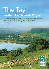
Final report taking shape

This is the front cover of TWCP final report. We have agreed the text of the main report, and are currently organizing a strategy for launching later in summer. Getting the timing right is going to be tricky, but we are meeting again on 1st July to finalize a plan.
Saturday 5 June 2010
The Upper Lochay- natural drought flow

The Lochay is not going to be abstracted this summer because of maintenance to the pipelines. Therefore, we will see a natural flow down the river for the first time in many, many years. Unfortunately, the current drought means that the river is still very low. Although it is hard to make a proper judgement, it would appear that the lower river is well down on usual levels (no water coming back from Glenlyon) but the upper river appears to be fuller, despite the side burns being almost dry.
It will be really interesting to keep an eye on things this summer.
The Innisraineach Burn Unplugged

The current shut- down provides an excellent opportunity to see some of these watercourses when they are not being abstracted.This watercourse runs down beside the pipeline to Glenlyon. Normally this would be full of water, overflowing down the grid in to the pipe. The sluice gate has been lifted and all the water (not very much because of the dry weather) is going down the main burn.


How it works......

When the sluice gate is down, the water dams up and goes down the grill in to the pipe leading to Glenlyon. The grill keeps out floating debris. Sediment sinks to the bottom.
Simple but devastatingly effective.
VIDEO- Further down the burn.......
This is the water at the bottom end of the burn, just as it enters the Lochay.
This is interesting.........

We were here in 2008 on a TDSFB visit, when the river at this point was no more than 6 ft wide and most of the stones here under water were sitting dry. It would appear that even in drought conditions, there is more water in the UPPER Lochay than when it is being abstracted.


Subscribe to:
Posts (Atom)