Friday, 18 June 2010
Friday, 11 June 2010
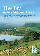
Final report taking shape

This is the front cover of TWCP final report. We have agreed the text of the main report, and are currently organizing a strategy for launching later in summer. Getting the timing right is going to be tricky, but we are meeting again on 1st July to finalize a plan.
Saturday, 5 June 2010
The Upper Lochay- natural drought flow

The Lochay is not going to be abstracted this summer because of maintenance to the pipelines. Therefore, we will see a natural flow down the river for the first time in many, many years. Unfortunately, the current drought means that the river is still very low. Although it is hard to make a proper judgement, it would appear that the lower river is well down on usual levels (no water coming back from Glenlyon) but the upper river appears to be fuller, despite the side burns being almost dry.
It will be really interesting to keep an eye on things this summer.
The Innisraineach Burn Unplugged

The current shut- down provides an excellent opportunity to see some of these watercourses when they are not being abstracted.This watercourse runs down beside the pipeline to Glenlyon. Normally this would be full of water, overflowing down the grid in to the pipe. The sluice gate has been lifted and all the water (not very much because of the dry weather) is going down the main burn.


How it works......

When the sluice gate is down, the water dams up and goes down the grill in to the pipe leading to Glenlyon. The grill keeps out floating debris. Sediment sinks to the bottom.
Simple but devastatingly effective.
VIDEO- Further down the burn.......
This is the water at the bottom end of the burn, just as it enters the Lochay.
This is interesting.........

We were here in 2008 on a TDSFB visit, when the river at this point was no more than 6 ft wide and most of the stones here under water were sitting dry. It would appear that even in drought conditions, there is more water in the UPPER Lochay than when it is being abstracted.


Saturday, 13 March 2010
Weir at the falls of Lochay

I was asked to go up to see the Lochay today as apparently it was nearly dry. However, by the time I got up, some-one had turned the tap on...!! What you see here and in the subsequent two photos is the result of snow melt.....there was nothing here 6 hours previously. Amazing...!!
The Falls of Lochay

This is the Falls of Lochay through some branches....you can see there is a series of three falls. The top and bottom ones are passable to salmon, but the middle one is not.


Monday, 8 March 2010

Tuesday, 23 February 2010

Friday, 19 February 2010


Thursday, 18 February 2010
TWCP Report front cover photo

This photo of Killin will form the front cover of our final report.
Helen Meek of Ardessie Publishing, Dundonnell,near Ullapool, will be designing our final report.
We will be making best use of all the photographic material that we have.
TWCP Back page photo

This picture will form the centre of the back page. This is the Lyon at Roroyere.

Hydro abstraction point

Water abstraction issues will be one of the key issues we want to highlight.
Monday, 15 February 2010
Light coloured water vole

I got this great photo today from Katy Freeman who works for Forestry Commission Scotland in Cowal & Trossachs Forest District. We did some water vole survey work for Katy last autumn down by Lochgoilhead. She is managing a water vole release programme within the Loch Lomond & Trossachs National Park, using water voles rescued from a development site in Glasgow. There was a danger that the genetic base of the introduced population might get too narrow, so we arranged for her to capture some immature water voles in Glen Lochay, at a site that we found in 2007, and these will be used to breed with her captive voles to give her a wider genetic base.
We will use this photo in pole position in the water vole section of our final report. This water vole is light coloured. The Scottish population has a high proportion of black animals but many are also the brown variety and some are a grey, brown , blackish in-between colour.
Well done Katy.

Newtyle on the Tay

Here are a couple of images of boats on the Tay, to be included in main report in a short section on the Tay Ghillies Association, one of our key funders.

Sunday, 14 February 2010
Comrie Bridge, Lower Lyon

This collection of 42 photographs will be inserted as eight pages of plates in our final catchment report in addition to the further 80-100 used to illustrate points in the main body of the report itself. Our catchment survey has allowed us access to these glens in all weathers and at all times of year, from the rivers right up to the high hill tops. There are lots of things going on all the time.
The images can be expanded to full screen size simply by clicking on them


Subscribe to:
Posts (Atom)